A view from the top
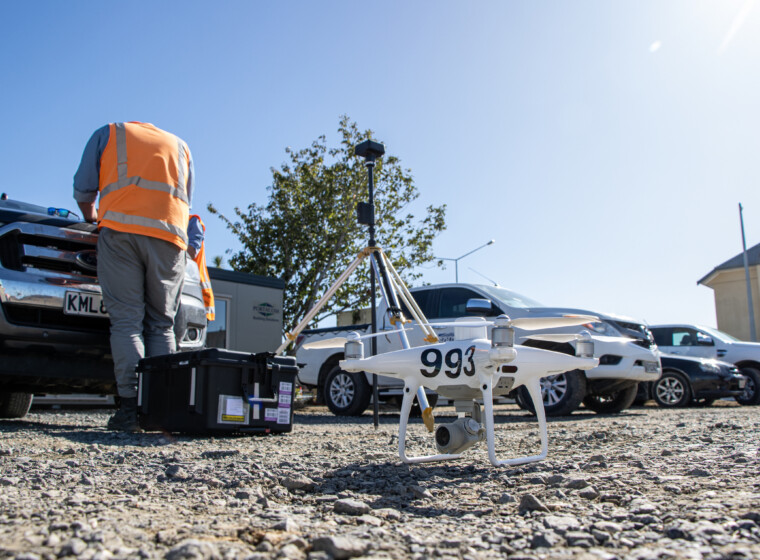
While drones – or Unmanned Aerial Vehicles (UAVs) – have been around for a while, their proliferation into SouthRoads has seen them be a welcome addition to the business’ surveying toolkit.
SouthRoads Strategic Projects Manager Danny Shayler said there were four drone operators across the business and SouthRoads was Civil Aviation Authority (CAA) 102 accredited.
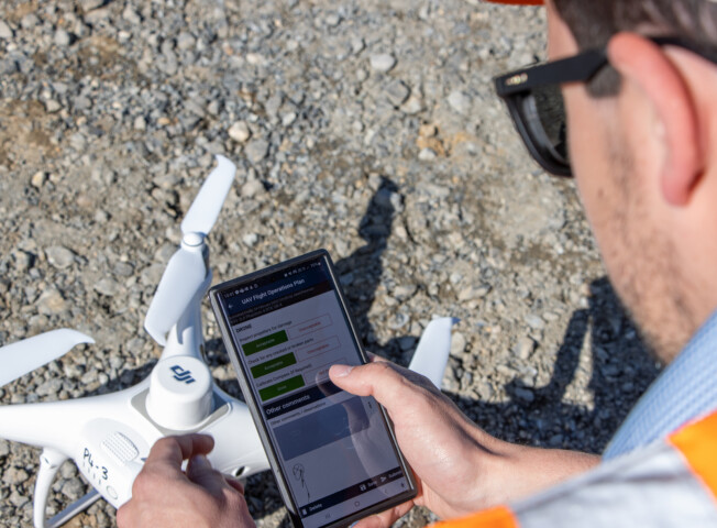
“It gives our stakeholder the confidence our pilots are trained and have safety management systems in place.”
Construction surveying, navigation, farm surveying, gravel pits, emergency services – there’s a lot of ways to apply drones.
At the moment, drone surveying is being offered to HWR’s internal divisions, along with some farming and emergency services work. Working with outfits such as Waka Kotahi and the NZ Police, drone surveying captures an accurate overview of a designated area through a series of images, which are then fed into software that maps out the captured area’s terrain.
For example, drone surveying can capture an accurate horizontal image of a crash site for NZ Police, or it can produce a 3D image of a construction site complete with the different kinds of terrain on the farm. Within transport, drone surveying can also be used to map a route ahead of time to determine the best course to take. When transporting big loads such as wind turbines to sites, this allows teams to consider which roads provide the best route, taking into account tight corners and such.
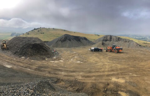
Drone surveying is as accurate as traditional methods, but in some jobs it can significantly speed up processes. When mapping out gravel pits, this is a process that takes around 2-3 weeks with traditional surveying methods. Using drones, this comes down to 2-4 days.
“Because we are getting an overall look at the terrain with a high level of detail and it being geo-referenced, this gives us the ability to make highly accurate measurements, such as distance, area and volume,” Danny said.
One specific application of drone work that complements SouthRoads’ surveying services is working with Halter – a virtual fencing system that allows farmers to fence cow herds without the use of physical fences.
Cows are fitted with ergonomically designed smart collars that proactively monitor them for signs of ill health but also send signals to the cow when they approach the “fence” boundary. Using drones to map out where the geofence could be virtually constructed, Halter allows farmers to have fenced herds without the physical labour of staff having to fence herds and maintain structures.
“Working alongside Halter and our software partner DroneDeploy has enabled us to explore what other services we could provide to the agriculture sector with several different map types, including elevation maps, plant health and stand counts,” Danny said.